At Birds Eye Aerial Drones (BEAD), we stand as your premier partner in the rail and transportation sector, dedicated to revolutionizing asset management, safety assurance, and infrastructure maintenance. Our commitment to excellence and innovation drives us to deliver custom drone solutions, perfectly tailored to meet the industry’s unique demands.
Efficient and Accurate Drone Railway Inspection Services by Birds Eye Aerial Drones
Launch Your Projects to New Heights
Roads, Railways & Drones:
Elevating Efficiency, Safety, and Precision in Transportation Infrastructure
Roads, Railways & Drones:
Elevating Efficiency, Safety, and Precision in Transportation Infrastructure

At Birds Eye Aerial Drones (BEAD), we stand as your premier partner in the rail and transportation sector, dedicated to revolutionizing asset management, safety assurance, and infrastructure maintenance. Our commitment to excellence and innovation drives us to deliver custom drone solutions, perfectly tailored to meet the industry’s unique demands.
Why Birds Eye Aerial Drones is Your Go-To for Rail and Transportation Projects
Why Birds Eye Aerial Drones is Your Go-To for Rail and Transportation Projects
- Checking Things Out: To prevent service interruptions and assist in infrastructure management and maintenance we conduct detailed inspections of bridges, railways, and roads’ essential components, aiding in the early identification of issues.
- Keeping Everyone Safe: Foster a safer environment for both your workforce and customers. Through real-time monitoring we highlight potential hazards.
- Making Things Better: Streamline maintenance schedules and enhance asset longevity by gathering critical data on asset conditions via our drones.
- Making Things Quicker: Our technology minimizes manual labor and expedites the inspection process, leading to operational efficiency.
- Imagine and Measure: Support your planning and development with our precise mapping and topography services, driven by accurate drone data and control points.

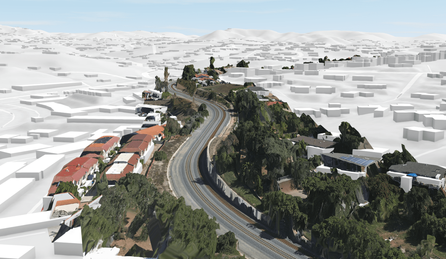
Client Success Story:
NCTD Drone Railway Inspection
Our collaboration with the North Country Transit District (NCTD) shows our capability to safeguard vital transportation infrastructures. Initially tasked with monitoring for erosion around railway tracks near beach line cliffs, our drones established a baseline for stability, playing a crucial role in landslide prevention along with track and personnel safety. This initiative highlights how our drone services contribute to maintaining the integrity of critical transport routes, particularly in challenging environments.
Client Success Story:
LA Metro GIS Rail Mapping Pilot Program
Our partnership with LA Metro highlights our passion for innovation. As part of LA Metro’s pilot GIS railway mapping initiative Birds Eye Aerial Drones was chosen from among several other applicants. Our client was looking for a way to create highly accurate maps for use in their platform. This would allow several departments to all have access to this vital information for use in planning, inspections, real estate and training. Our professional flight teams and our flight operations were able to work closely together to both navigate the highly regulated airspace of the city of LA but also to provide the data our client needed. This played a crucial role in track management along with track and personnel safety. This effort showcases the vital role our drone services play in preserving the safety and reliability of essential transportation pathways, especially in difficult conditions.
Client Success Story:
Roads and Railways Inspection Services by Birds Eye Aerial Drones
At Birds Eye Aerial Drones, we are proud to deliver cutting-edge Drone Railway Inspection Services and Drone Road Inspection Services that prioritize safety and efficiency. Our work with LA Metro’s GIS railway mapping pilot program demonstrates our commitment to innovation and safety. Chosen among multiple applicants, we partnered with LA Metro to create highly accurate maps, empowering their teams to streamline planning, inspections, real estate management, and training processes.
Our professional flight teams navigated the complex, highly regulated airspace of Los Angeles to provide the precise data our client needed. These maps played a crucial role in track management while enhancing safety for both tracks and personnel. By utilizing our rail line inspection drone services, LA Metro significantly reduced the need for workers to be present in the right-of-way (ROW), minimizing exposure to hazardous environments and ensuring the safety of their teams.
Whether it’s for railway inspection drone services, road inspection drone services, or drone highway inspections services, Birds Eye Aerial Drones is the trusted partner for safety-focused solutions. As a leading railway inspection drone company in California, we ensure that vital transportation infrastructure is inspected with unmatched precision, reducing risks and optimizing operations.
Discover how our railway inspection drones and road inspection drone company services can transform the way you manage and maintain your transportation pathways. Partner with us for innovative solutions that deliver safety, accuracy, and reliability.
Join the Future of Rail & Transportation Today
Elevate your rail and transportation operations with Birds Eye Aerial Drones. By integrating our drone technology, you can enhance efficiency, improve safety, and ensure precision across all operations. Together, we'll redefine the future of transportation, guaranteeing reliability and excellence at every turn.
Are you ready to see how our drone solutions can transform your rail and transportation services? Contact us today to explore a tailored approach to operational success.
Submit Your Inquiry
Aerial Drone Services & GIS Insights


First and foremost, BEAD is an SDVOSB company providing turnkey aerial imaging solutions and consulting to help you improve your ROI. For example, do you require actionable aerial data for mapping & environmental monitoring? Perhaps aerial imagery for the entertainment, AEC, utility or communications industry? In fact, we’ve got just the right solution to meet your needs.
Above all, we observe all local, state & federal flight safety regulations, as applicable and are $10M insured.