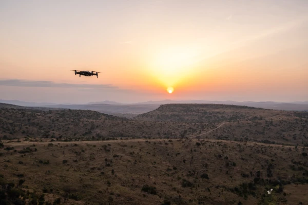
Advanced UAS
Operations: Diverse
UAS Fleet
Learn More

Trusted Drone Services in California | Veteran-Owned | FAA-Certified
At Birds Eye Aerial Drones (BEAD), we deliver professional drone services in California, USA that empower industries with actionable data, crystal-clear imagery, and cost-saving efficiency. Headquartered in San Diego, our aerial drone services have supported utilities, construction, agriculture, government, and environmental projects across California and beyond.
With over 28,000 missions, 25,000+ incident-free flight hours and 350,000+ utility assets inspected, we’ve built a proven reputation as the drone company trusted by utilities, engineers, and agencies that can’t afford mistakes. Whether you need aerial drone inspections, drone mapping services, or cinematic drone aerial photography services, BEAD delivers precision, safety, and speed—every time


Transformative Unmanned Aerial Drone Services & GIS Insights

Commercial & AEC
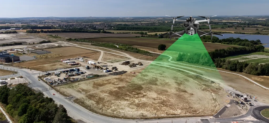
Developers, architects, and commercial realty firms rely on our aerial photography drone services and drone surveying

Agriculture
Through our agriculture drone services, including agriculture drone spraying and crop monitoring, we deliver data…

Utilities & Energy
Our utility drone solutions help providers keep the grid reliable. From UAV utility inspections to aerial vegetation…
Environmental
We provide environmental drone monitoring services and GIS mapping that help organizations measure impact, restore…

Government
As a California Drone Service Company, BEAD supports federal, state, and municipal agencies with aerial inspection services for…

Road and Railways
We support transportation and civil engineering projects with aerial mapping surveys and drone railway inspection…


We had the pleasure of partnering with Birds Eye Aerial Drones for our SDG&E DIAR Project Oversight and couldn't be more impressed with their operational capabilities, commitment to safety, and the exceptional quality of their service.
Burns & McDonnell
The BEAD Team’s delivery was flawless. The drone services provided by BEAD enhanced the construction contract bidders information and contributed to a successful bid for the Inland Rail Trail Phase 3B project.
Project & Construction Manager, PGH Wong
Working with Birds Eye Aerial Drones was an absolute game-changer for our project. Their professionalism, expertise, and dedication to delivering top-notch field capture imaging solutions have truly exceeded our expectations.
Private Electric Utility Client
BEAD’s professionalism, expertise, and commitment to excellence make them the ideal partner for delivering outstanding aerial imagery solutions!
Private Transportation Engineering Client
Our project involved steep landscape & dense vegetation. BEAD conducted an accurate survey & generated reports in the right file format for our civil engineering team. Great service & competitive rate, I’ll certainly use BEAD on our next project.
ZAR Construction
I'm a Lean Six Sigma Black Belt and BEAD changing the forms to flow better for their employees out in the field will help with ROI, being time. Love the continuous improvement!
Confidential Client

Birds Eye Aerial Drones aims to redefine aerial intelligence by delivering dependable, actionable data with unmatched safety and integrity. Our mission is to make the skies safer and smarter, serving both private, public & government sectors with excellence and expert-driven innovation.
Join Our Team
At Birds Eye Aerial Drones (BEAD), we are on the lookout for great people. If you’re a highly motivated, detail-oriented, and safety-minded individual, please complete form at the link below. We look forward to hearing from you.
Join Our Team
At Birds Eye Aerial Drones (BEAD), we are on the lookout for great people. If you’re a highly motivated, detail-oriented, and safety-minded individual, please complete form at the link below. We look forward to hearing from you.


Reach out to Birds Eye Aerial Drones today!
Have a Part 107 Remote Pilot in Command Certificate
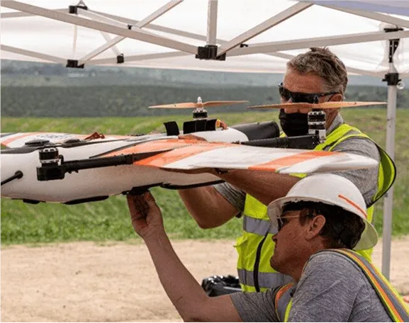
As required by law, our pilots have a Part 107 Remote Pilot in Command Certificate with a UAS Rating. Along with the aforementioned, our pilots have years experience with fixed-wing and rotor wing UAS piloting experience. Willing to travel worldwide.

Did You Know This About The Drone Industry?
$180M
Utility industry savings (2025)
800k+
Paid deliveries (2023)
460,375
Remote Pilots (FAA, Jul 2025)
$10,200/bridge
FHWA average savings
Did You Know This About The Drone Industry?
$180M
Utility industry savings (2025)
800k+
Paid deliveries (2023)
460,375
Remote Pilots (FAA, Jul 2025)
$10,200/bridge
FHWA average savings
Latest News
Drone Mapping
Pre-Construction Site Planning with Aerial Drone Mapping
There is a moment before every project begins when the site tells the truth. Not the version shown in the…
LiDAR Technology
How LiDAR Technology Is Transforming Modern Surveying?
There’s a moment every surveyor, PM, and engineer knows. You’re standing at the edge of a site, looking across terrain…
Drone Inspections

Drone Services That Deliver Proof, Not Just Photos
The Moment Before You Commit Most teams do not wake up wanting “a drone flight.” They want certainty. They want…
Drone Inspections

Why Construction Companies Are Adopting Drone Inspections in 2026?
Construction teams are being asked to move faster, document more, and miss less, all while the jobsite stays just as…
Drone Photography

Why Businesses Are Switching to Professional Drone Photography Services?
You look at what you built, and you feel proud. Then you look at the photos and video meant to…
Drone Inspections

How Drone Road Surveys Are Transforming Highway Planning in 2026?
If you work in highway planning, you already know the feeling: the corridor you are responsible for is never standing…
Drone Inspections

Reducing Downtime with Drone-Based Asset Inspections
Downtime is one of the most expensive and disruptive realities asset owners face. Whether in utilities, industrial facilities, transportation corridors,…
Drone Inspections

How Drone Solar Farm Inspections Are Transforming Performance, Safety, and Asset Confidence?
Solar farms are built to power the future. Acre by acre, panel by panel, they convert sunlight into reliable, renewable…
LiDAR Technology

Top Key Benefits of Using Drone LiDAR for Construction Projects
Construction projects rarely slow down by choice. They slow down because information arrives too late, conditions change without warning, or…
Drone Inspections

Smart City Air Support in Action: What Drone Services Look Like on the Ground
Cities don’t experience infrastructure challenges in strategy sessions. They experience them when crews are standing in traffic, when inspections fall…
Drone Utility Inspection

From Aging Infrastructure to Drought Resilience: Drones as the Utility Workhorse in California
California’s utilities are standing at a crossroads. Decades-old infrastructure is under pressure from record heat, intensifying wildfire seasons, Santa Ana…
Drone Utility Inspection

Flying Ahead of Wildfires: How California Utilities Use Drones for Safer, Smarter Grid Management
California’s municipal utilities face a new reality: wildfire seasons that are growing more intense each year, aging grid infrastructure, and…
Drone services

Flying Forward: How Drone Services in San Diego Are Supporting California’s Largest Infrastructure Projects
When we talk about replacing a 62-year-old bridge that supports one-third of all U.S. containerized shipping volume, it’s easy to…
Aerial Drone Inspections

How Aerial Drone Inspections Are Transforming Golf Course Maintenance and Saving Up to $200K a Year?
Golf course maintenance has always been a delicate balance between beauty, performance, sustainability, and budget. When each fairway, green, and…
Drone Inspections

Important Role of UAV Inspection in Wind Turbine Blades
Wind energy is one of those rare places where innovation, sustainability, and courage collide. Standing at the base of a…
Environmental Drone Service

How Drones Help Protect Wildlife During Large-Scale Construction Projects?
Birdseye Aerial Drones, Environmental Drone Services, Environmental Drone Service, Environmental Monitoring Drone Services California, Environmental Drone Services California
Drone Solutions

Excellence in Flight: How Birds Eye Aerial Drones Defines and Refines Exceptional Work
When people search “drone service near me” or “professional drone solutions,” they’re not just looking for a vendor. They’re looking…
Disaster Drone Inspections

Disaster Response: How Drone Inspections Support Rapid Recovery Operations
When disaster strikes, heroes rise, the firefighters, linemen, search-and-rescue teams, and emergency responders who run toward danger when others flee.…
Drone Inspections

How Do Drones Help Detect Early Structural Damage in U.S. Bridges?
Every day, more than 617,000 bridges support the movement of over 200 million vehicles across the United States. They connect…
Railway Drone Inspection

Drone vs Manual Inspection: Which Is Better for Railway Maintenance?
If you’ve ever walked alongside a rail line, watched the interplay of sleepers, ballast, ties, fasteners, and mile after mile…
Turn Complexity into Confidence with NAVIGATE™ by Birds Eye Aerial Drones
Standardized workflow. Utility-grade accuracy. Zero guesswork, from needs assessment to final deliverables.
Why Choose Birds Eye Aerial Drones?
01
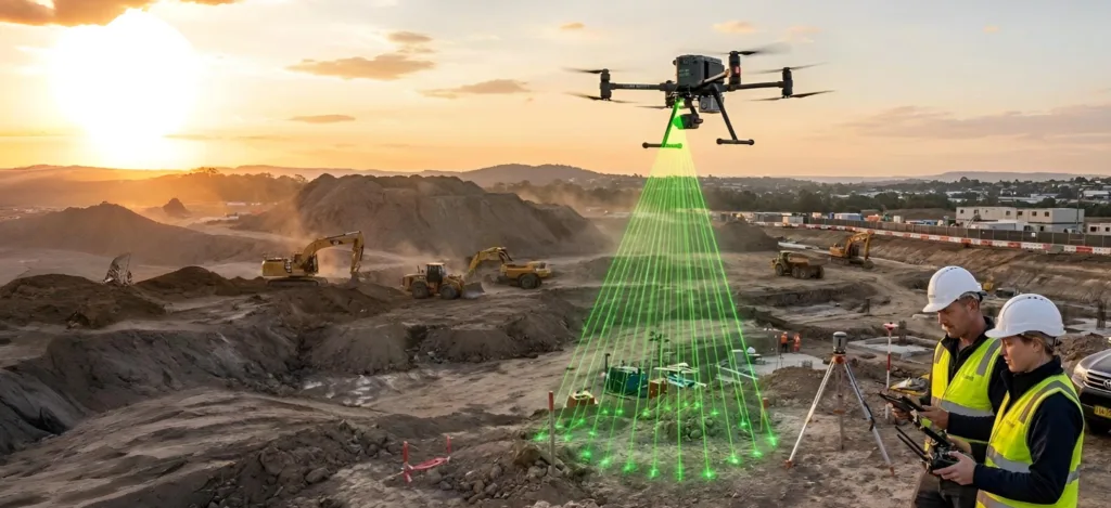
±2 cm Accuracy with RTK/PPK-enabled flights
02
Up to 60% Faster Inspections compared to traditional field methods
03
30–40% Cost Savings per inspection cycle
04
80% Safer for crews by reducing exposure to hazardous conditions
05
Zero FAA Reportable Incidents in over a decade of operations
Our clients save time, money, and risk while gaining real-time insights to make smarter decisions.

Our Commitment:
Safety & Integrity
BEAD isn’t just a drone service near you—we are a veteran-owned, FAA Part 107-certified, $10M insured drone service provider. Every mission is backed by military-grade discipline, aviation expertise, and a culture of safety.
We’re proud to be a Service Disabled Veteran-Owned Small Business (SDVOSB), creating opportunities for veterans and supporting community programs across San Diego. Each year, we donate aerial drone services to honor our military heritage, including support for Navy Chief Pride Day with the Enlisted Leadership Foundation.
Ready to elevate your operations?
Contact Birds Eye Aerial Drones today for the most trusted aerial drone services in California.
