At Birds Eye Aerial Drones (BEAD), our certified GIS professionals deliver tailored mapping and data solutions to empower informed decision-making. With our easy-to-use GIS maps and datasets, you’ll enjoy on-time, cost-effective insights for engineering, construction, environmental, and planning projects. We combine GIS and drone technology to enhance project efficiency and ensure compliance with federal, state, and local regulations, supporting agencies, engineers, planners, property owners, and other professionals with CEQA, DAHP, NEPA, NHPA, HRS Chapter 6E, and beyond.
Geospatial Information Systems (GIS) Services
Our GIS Services
Our GIS Capabilities
- GIS Consulting & Needs Assessments
- ArcGIS Online Implementation
- Web GIS & Mapping Applications
- Interactive Web Maps
- Geospatial Data Collection
- Asset Management & Impact Analysis
- Site Selection & GIS Modeling
- Geodatabase Design & Spatial Analysis
- Data Management & Visualization
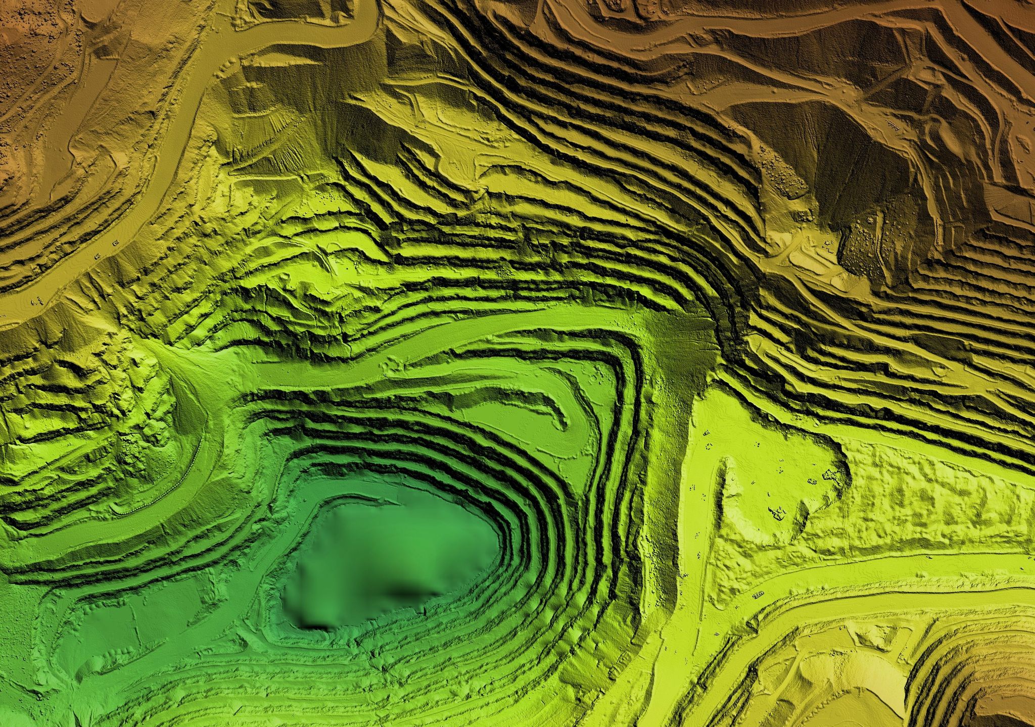
- Legacy Data Conversion & Aerial Drone Mapping
- Terrain Modeling, Orthomosaic Mapping, & Cartography
- Remote Sensing, Exhibit Maps, & Land Use Mapping
- 3D Modeling
Trusted by agencies and clients nationwide, BEAD delivers advanced GIS and geospatial services for projects of all scales, from small site analyses to large-scale compliance requirements. Let our expertise and technology elevate your project to new heights.
Why Choose Birds Eye Aerial Drones for GIS Services?
With our robust GIS mapping services, spatial data analysis, and geospatial analysis, Birds Eye Aerial Drones transforms complex data into actionable insights that drive success. Our GIS consulting services are tailored to your specific needs, helping to identify the most effective geospatial solutions for your project. By incorporating cutting-edge remote sensing and GIS technologies, we deliver precise, efficient, and reliable data to enhance your workflows.
Our expertise in cartography and map design ensures visually impactful and accurate deliverables, while our focus on GIS application development streamlines your operations with intuitive tools and systems. Birds Eye Aerial Drones also excels in GIS data management, ensuring your geospatial datasets are organized, accessible, and ready to support critical decisions. For projects requiring environmental GIS services, our team provides detailed analysis and visualization to meet compliance standards and protect natural resources.
From geographic data visualization to comprehensive GIS mapping services, BEAD is committed to elevating your project outcomes. Let Birds Eye Aerial Drones’ innovative technology and trusted expertise lead your project to new heights.
Submit Your Inquiry
Aerial Drone Services & GIS Insights


First and foremost, BEAD is an SDVOSB company providing turnkey aerial imaging solutions and consulting to help you improve your ROI. For example, do you require actionable aerial data for mapping & environmental monitoring? Perhaps aerial imagery for the entertainment, AEC, utility or communications industry? In fact, we’ve got just the right solution to meet your needs.
Above all, we observe all local, state & federal flight safety regulations, as applicable and are $10M insured.