
You’re not just responsible for power—you’re responsible for peace of mind.
When you’re in charge of maintaining a utility grid, a substation, or a transmission corridor, your role goes far beyond wires and poles. You’re safeguarding lives, livelihoods, and the essential infrastructure that powers our homes, hospitals, and schools.
But here’s the hard truth: the traditional way of inspecting infrastructure isn’t just slow—it’s risky, reactive, and expensive.
That’s where the story changes.
That’s where you step into the role of innovator, protector, and pioneer.
And that’s where LiDAR drone utility inspection technology becomes your trusted guide.
The Call to Action: Outdated Systems Can’t Keep Up
You’ve seen it firsthand—manual walkouts, helicopter flyovers, and boots on the ground that still miss hidden faults. You’ve had to react to emergencies rather than prevent them. But your team deserves better. Your community deserves better. And now, that “better” is here.
LiDAR drone services for utilities a revolutionary way to scan, survey, and safeguard your assets with unmatched clarity and speed.
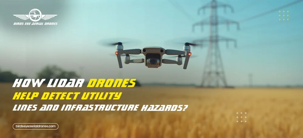
Crossing the Threshold: Seeing the Unseen
LiDAR drone infrastructure monitoring isn’t just about flying a drone with a cool sensor. It’s about transforming invisible threats—like sagging lines, encroaching vegetation, and micro-fractures—into actionable, visual data.
By capturing millions of elevation points per second, our LiDAR-equipped drones generate 3D models so precise, they expose the tiniest hazard before it becomes a crisis. Think powerline clearances, thermal anomalies, erosion around footings… all revealed in high-res, sub-centimeter accuracy.
That’s the magic of LiDAR drone utility inspection: turning the unseen into understood.
Also Read: LiDAR Technology: The Key to Accurate 3D Mapping and Modeling
The Numbers Tell the Story
- Utilities using LiDAR drones report up to 80% reduction in emergency maintenance costs.
- Our clients have accelerated inspection schedules by over 60% compared to traditional methods.
- And our drone infrastructure monitoring has helped detect faults in remote regions weeks before system failure.
Every inspection isn’t just a task—it’s a preventative action that saves money, time, and risk.
The Tools of the Hero: Drone Services San Diego to the Rescue
At Birds Eye Aerial Drones, we’ve supported some of California’s most complex inspection projects. Our aerial drone inspection service offers:
- LiDAR + RGB + thermal payloads
- FAA Part 107-certified teams
- RTK-enabled flights for accuracy within 1-3cm
- Fully insured, fully documented data capture
- GIS-ready outputs for seamless integration into your asset management platforms
From San Diego utility corridors to remote desert substations, we know how to operate safely, swiftly, and with zero footprint.
“Partnering with Birds Eye Aerial Drones was a turning point for our inspection program. Their LiDAR drone services helped us detect infrastructure hazards we didn’t even know existed — and prevented what could’ve been a million-dollar outage. Fast, precise, and easy to integrate into our GIS systems — it’s the smartest decision we’ve made this year.”
— Senior Asset Manager, Regional Utility Provider
The Transformation: From Reactive to Resilient
The journey isn’t just about adopting tech—it’s about changing the way you protect your grid. With the power of LiDAR drone services for utilities, you’re no longer reacting to outages… you’re engineering resilience.
You’re leading your team into a future where your inspections are smarter, your data is real-time, and your operations are safer.
You’re the hero here.
And we’re proud to be the drone utility inspection partner by your side.
Ready to see the unseen?
Let’s put your power lines under a whole new lens—one that sees every angle, every clearance, every risk… before it ever becomes a headline.
📩 Contact Birds Eye Aerial Drones to schedule your next LiDAR utility inspection today.